The Pharos of Alexandria has left no standing tower for an archaeologist to measure. Its name survives in texts, images, place names and submerged architecture, but those traces do not all answer the same question. A block recovered from the Eastern Harbour can illuminate the history of Alexandria without proving that the block belonged to the lighthouse. The most responsible account therefore begins with a distinction: the underwater site contains material associated with the ancient city and its harbor, while the identification of any one object as Pharos fabric requires a separate argument.
A harbour site rather than a single building
The Centre d'Études Alexandrines describes a submerged archaeological area near Qaitbay fort in Alexandria's Eastern Harbour. The site is not a neat footprint surrounded by empty water. It lies within a harbor reshaped by construction, erosion, deposition and changing shorelines. The nearby fort itself occupies the island of Pharos, and the port has accumulated structures and debris from different periods. In that setting, an underwater survey has to distinguish locations and layers before it can attribute objects to a particular building.
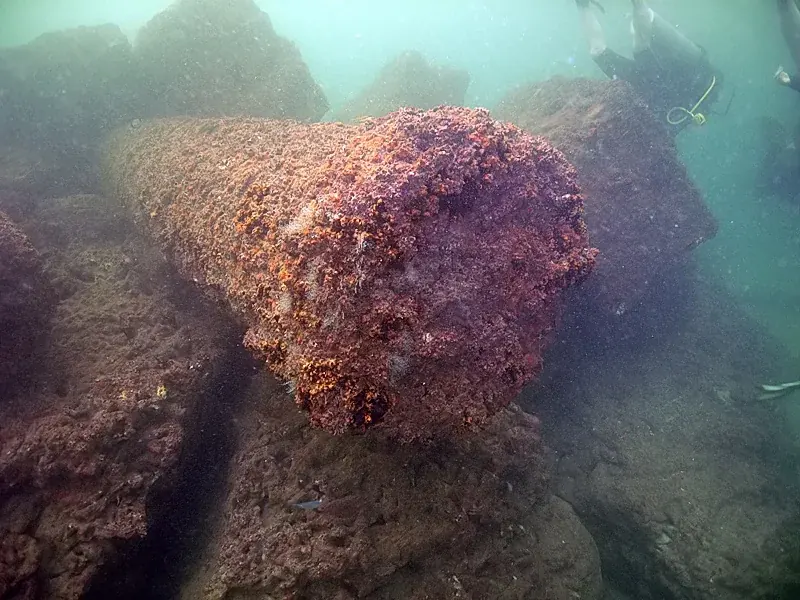
CEAlex's excavation account names architectural elements, inscriptions, sphinxes, obelisks and fragments of colossal statuary among the material recorded or lifted from the water. Some pieces are displayed at the Roman Theatre and near the Bibliotheca Alexandrina. The variety is a warning against treating the entire assemblage as one fallen tower. Alexandria's harbor was a working civic space for centuries; a submerged object may belong to a quay, a temple, a public monument, a later reuse, or a sequence that has not yet been settled.
Why the blocks cannot identify themselves
Stone size is not an attribution. A massive granite shaft, a carved figure or a dressed block may look spectacular in a photograph, but appearance alone cannot establish when it was made, where it stood, or whether it formed part of the lighthouse. Archaeologists compare dimensions, tool marks, inscriptions, material, joins and find location. They also ask whether the proposed object fits the known building history and whether another plausible structure could explain it. If the context is disturbed or the stone was reused, some of those clues can be weakened or lost.
Separate sectors, separate questions
CEAlex's published excavation summary distinguishes several archaeological sectors in the vicinity. It notes ruins north-west of Qaitbay fort, a Roman-era structure to the north-east, and a southern seawall that incorporates reused granite columns. That last detail matters: a column in a seawall is evidence both of an earlier object and of a later building practice. Its final position is not necessarily the place for which it was first made. A researcher must describe the reuse before arguing for the column's original role.
Photogrammetry adds a record, not a verdict
Underwater recording is difficult to repeat with the ease of a land survey. Visibility, water movement, depth, access and conservation concerns limit what divers can do during a visit. Photogrammetry addresses one part of that problem: overlapping photographs can be processed into a measured digital surface or three-dimensional record. CEAlex reports extensive digital documentation of blocks and models of the submerged site. Those records make it easier to compare forms, plan a survey, and let other specialists inspect a measurement without repeatedly disturbing the site.
A digital model does not decide an object's identity by itself. It can show shape, orientation and relationships that might be hard to see in separate photographs, but its historical interpretation still depends on context and comparison. A model can be precise about the surface it records while leaving the object's date or original purpose unresolved. The difference between precision and certainty is easy to miss on screen: a beautifully rendered block may look conclusive even when the evidence supports only a cautious description.
What a reconstruction can and cannot do
Reconstruction is most useful when it labels its evidence. Researchers can compare surviving architectural pieces with depictions, test alternative arrangements, and show where a proposed form remains hypothetical. A responsible illustration should not erase the line between observed and inferred features. In particular, the familiar square lower storey, octagonal middle stage and cylindrical crown should be presented as a scholarly reconstruction supported by comparisons, not as a photographically verified profile of the vanished lighthouse. Several reconstructions can be plausible without all being equally supported.
Write an object history in three columns
For a hypothetical dressed block, separate observation, attribution and reconstruction. The first column can record its measured form and find location. The second states the proposed original building and the argument for it. The third shows how the block has been placed in a reconstructed elevation. A change in the second column need not invalidate every measurement in the first.
CEAlex's excavation account identifies ruins associated with the lighthouse as well as other structures and reused columns. That is a stronger institutional interpretation than merely saying nothing can be identified. At the same time, its identification of a sector does not assign every photographed stone to the same building. The scale of the claim must match the scale of the evidence.
Keep dates on digital coverage figures too. A model's recorded extent at one point in a project is not the present limit of the excavation or a final inventory. Readers can then distinguish a growing documentation program from a completed reconstruction of the vanished tower.